What is Geofencing?

What is a Geofence?
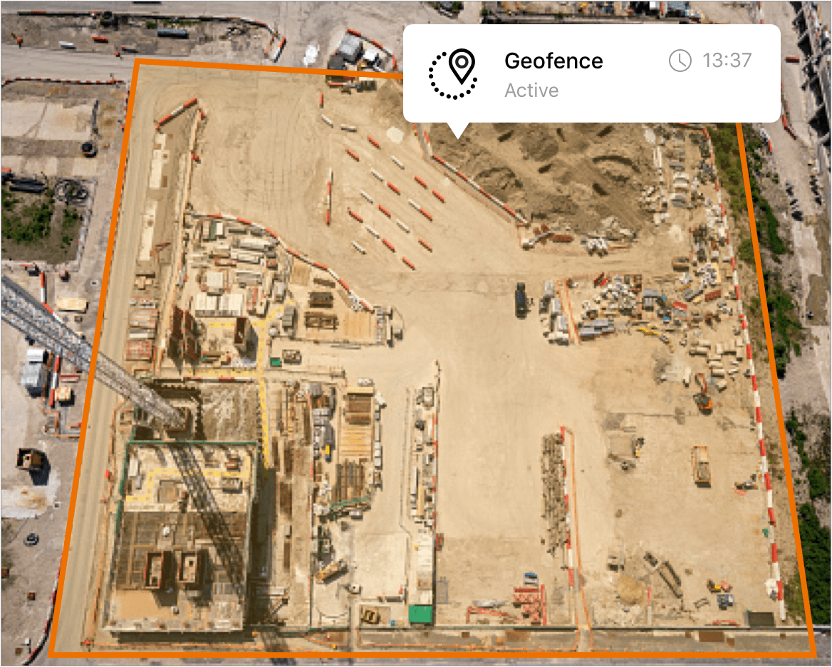
A geofence is a virtual fence or perimeter around a physical location. Like a real fence, a geofence creates a separation between that location and the area around it. Unlike a real fence, it can also detect movement inside the virtual boundary.
It can be any size or shape, even a straight line between two points.
Geofences are created using mapping software, which allow the user to draw the geofence over the desired geographic area. It is made up of a collection of coordinates (i.e., latitude and longitude) or in the case of a circular geofence one point that forms the center.
How does geofencing technology work?
What is the purpose of geofencing?
Why geofencing is needed varies from user to user. For example, some folks integrate geofencing with fleet management and telematics solutions to alert you via text message in near real-time if a vehicle or valuable piece of equipment with a GPS tracker attached is removed from the property without prior authorization.
Or, rather than being notified when something with a GPS tracker leaves your property, you can receive notifications when something unexpectedly enters it, too. A drone entering restricted airspaces is a good example of when geofencing could be used to notify you of an unauthorized occurrence.
Who is geofencing for?
Anyone with an interest in improving their current monitoring systems — whether for residential or commercial property — can benefit from geofencing. Those seeking to integrate digital surveillance into their personal home monitoring systems can place a geofence around their entire home to provide increased surveillance, notifying you of any unauthorized change within those areas.
Those aiming to enhance current processes in the workplace can set up a geofence around company grounds to optimize their current fleet management system.
How does geofencing relate to GPS fleet management software?
Whereas geofencing software is used to establish parameters and install digital fencing, GPS fleet management software is used to monitor belongings (like a company vehicle) once they’ve left the property. Additionally, GPS fleet tracking software can help businesses develop optimized routes and reallocate company spending accordingly.
Utilizing the two types of software together allows you to see how far a company vehicle has gone and how this aligns with the amount of gas used to hone in on company travel expenses. These tools are beneficial for businesses when used on their own. However, when paired together, it only doubles the security measures you’re taking to protect the company and its fleet.
Frequently asked questions about geofencing
What is geofencing used for?
Geofencing can be used to achieve many of your company goals. It’s up to you to first determine what your goals are. For instance, you chose to integrate geofencing to help reconfigure spending on fleet management. Or you could be improving current digital marketing tactics and need guidance honing in on a local audience.
Additional areas you can incorporate geofencing in the workplace include, but certainly aren’t limited to:
- Drone management;
- Audience engagement;
- Human resource management;
- Asset management;
- Internal security/law enforcement;
- Business automation.
You’ll want to take the time to reassess your current processes to determine what areas are doing well and where could use improvement. Be sure to communicate with your team along the way and educate them on any changes made.
What are the two types of geofencing?
There are two approaches to using geofencing technology — active and passive. Each has its advantages:
- Active geofencing is a real-time approach to continuously track a device’s location, monitoring the movement in defined geographical boundaries. This approach needs GPS, cellular, or Wi-Fi signals to determine the position of a device as it moves in and out of a designated geofenced area. Services must be enabled and an active internet or data connection for the real-time communication of active geofencing.
- Passive geofencing uses fewer resources and is more of a lightweight approach. Instead of continuously tracking a device’s movement, passive geofencing periodically collects data when triggered by certain events — such as when a device connects to a Wi-Fi network, or a specific app is opened.
Depending on how often you’d like alerts and response time, you may choose one over the other.
Is geofencing a tracking?
What is the difference between geofencing, geotargeting and geolocation?
While they sound the same, there are differences between geofencing, geotargeting and geolocation — each task is used for different reasons. To reiterate, geofencing software is used to put a digital perimeter around any given space.
Geolocation involves tracking a device’s location with the help of GPS, cell phone towers, Wi-Fi access points — or a combination of these tools. Geolocation can be used alongside geofencing when determining a device’s location within the perimeter set by geofencing technology.
Geotargeting is a more advertorial approach. It can use geofencing and geolocation to deliver targeted marketing content based on a device’s or user’s location.
Depending on what your goals are, you may use one or all of these methods.


